Introduction
On May 4, 1976, a remarkable satellite resembling a giant disco ball was launched into orbit, positioned nearly 3,700 miles (6,000 kilometers) above Earth. This shiny, two-foot-wide (60-centimeter) sphere, officially named the Laser Geodynamics Satellite (LAGEOS), was humanity's first spacecraft dedicated exclusively to laser ranging studies. Despite its age, LAGEOS continues to provide invaluable data, proving that simple, robust designs can yield extraordinary scientific dividends for decades.
A Purpose-Built Design for Precision
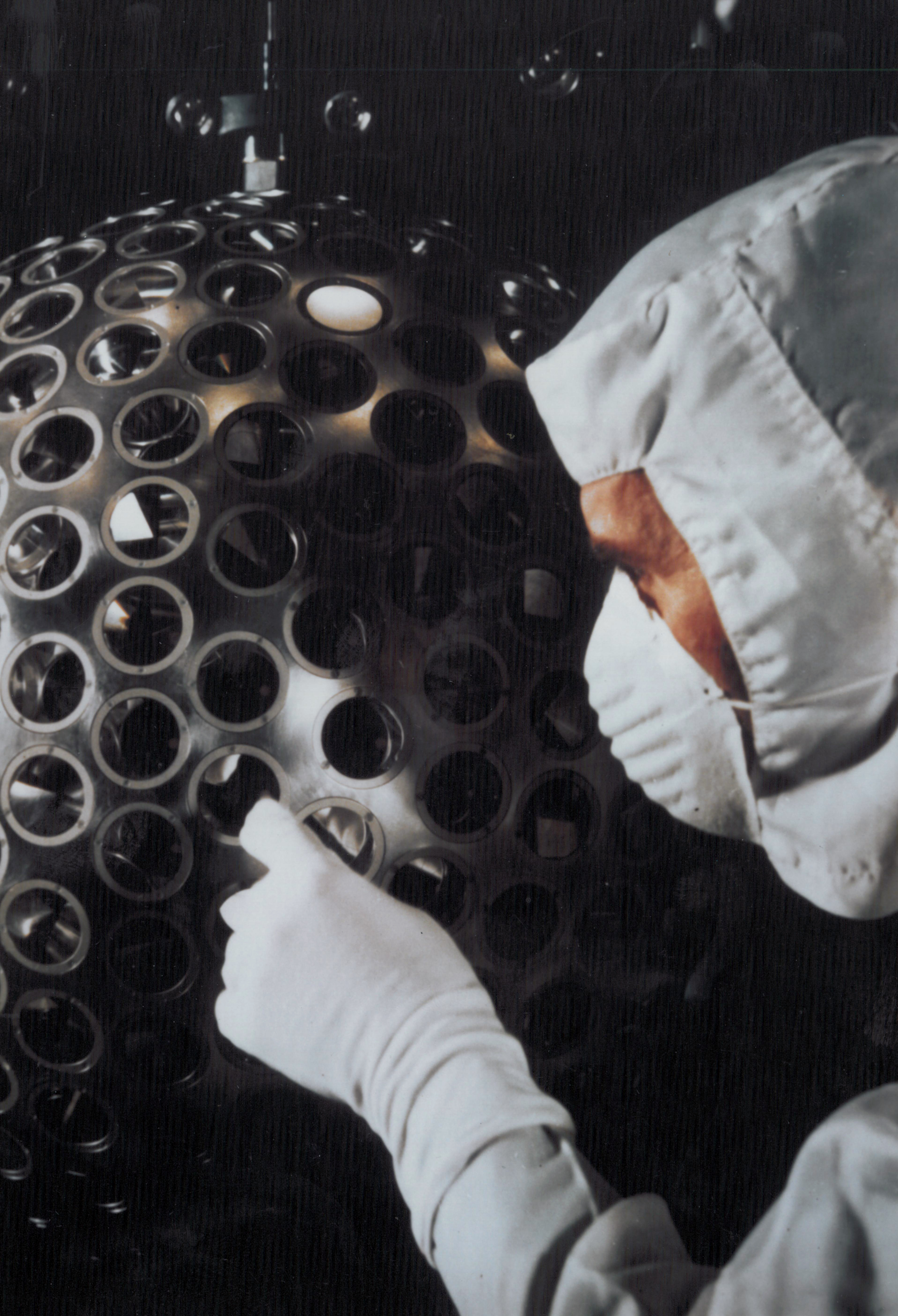
LAGEOS's outer shell is a gleaming aluminum sphere covered with 426 retroreflectors—small mirrored prisms engineered to reflect laser light directly back to its origin. Beneath this exterior lies a dense brass core, giving the satellite an unusually high mass of 900 pounds (400 kilograms) for its size. This heft was no accident; the satellite's high density and compact spherical shape ensure an exceptionally stable orbit, minimally affected by atmospheric drag or solar radiation pressure. Such stability is critical for satellite laser ranging (SLR), a technique that demands measurements accurate to within millimeters.
How Satellite Laser Ranging Works
Scientists at ground stations around the world fire short pulses of laser light at LAGEOS and precisely measure the time it takes for the reflected beam to return. Since the speed of light is known with extreme accuracy, the distance to the satellite can be calculated to within a few millimeters. By combining data from multiple stations, researchers can pinpoint LAGEOS's position with extraordinary precision. This technique has been refined over decades and remains a cornerstone of Earth science.
Scientific Contributions: From Plate Tectonics to General Relativity
Over nearly five decades, LAGEOS has provided a treasure trove of data that has transformed our understanding of Earth. Its measurements have tracked the slow drift of tectonic plates, monitored minute deformations of the planet's crust, and detected motion along major fault lines. These data have sharpened models of Earth's shape and gravity field, improving everything from navigation systems to climate studies.

Perhaps most remarkably, LAGEOS has contributed to tests of Einstein's theory of general relativity. By measuring subtle perturbations in the satellite's orbit, scientists have confirmed predicted relativistic effects, such as frame dragging and geodetic precession. The satellite's long, stable orbital history provides a unique laboratory for fundamental physics.
LAGEOS II: A Second Eye in the Sky
In 1992, the Italian Space Agency launched a near-twin satellite, LAGEOS II, aboard the space shuttle Columbia. With two satellites in complementary orbits, scientists gained even greater measurement accuracy. The pair serves as long-term benchmarks for Earth science, allowing researchers to separate various geophysical signals and refine their models. Together, they form a permanent space-based observatory for our planet's dynamic behavior.
Legacy and Future: A Mission for the Ages
Despite being one of the oldest scientific satellites still in operation, LAGEOS shows no signs of stopping. Its simple, maintenance-free design and the minimal drag encountered at its high altitude mean that the satellite will likely continue circling Earth for millions of years. Inside its core, a plaque designed by Carl Sagan carries a message for future civilizations—a testament to human curiosity and the enduring pursuit of knowledge.
For more on the history and design of LAGEOS, or to read about the scientific results it has enabled, explore the linked sections above. LAGEOS stands as a shining example of how a simple, well-executed mission can yield insights that span generations.